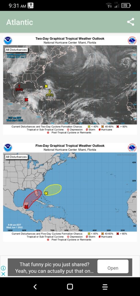
An extensive area of disturbed weather located near the Yucatan Peninsula is interacting with an upper-level trough over the Gulf of Mexico to produce a broad region of intense shower and thunderstorm activity. This system is moving in a northeastward direction and will move near the Northwest Bahamas during the night of Friday 3rd June, 2022. It will transverse the Florida Peninsula and exit the area by Monday 6th June, 2022.
Environmental conditions are conducive for gradual development, this system may develop into a Tropical Depression by the weekend. Hence, a Tropical Storm Watch may be issued for the Northwest Bahamas at this time.
Residents in the Northwest and Central Bahamas should prepare for severe and intense shower and thunderstorm activity with excessive rainfall. Prolonged rainfall resulting in localized flooding in low-lying areas is anticipated. The islands of Bimini, Grand Bahama, Berry Islands and Abaco will experience the brunt of this disturbed weather on Saturday 4th June, 2022.
The Bahamas Department of Meteorology will continue to monitor this system and update the public of any significant development.
The public should note that the 1st of June begins the 2022 Atlantic Hurricane Season and is therefore advised to continue preparations.


